|
INFORMATION:
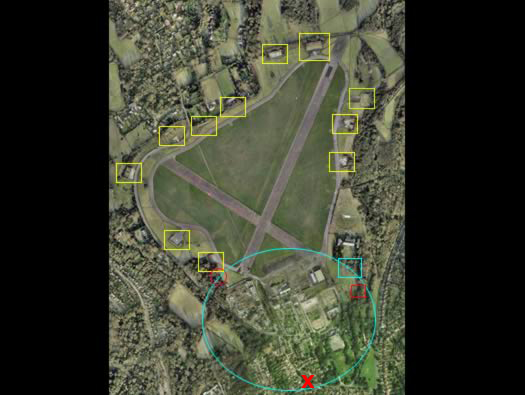
A plan of the airfield or aerodrome as it was called. Situated on the top of a hill to the south of Croydon, an ideal flying platform for biplanes but not fast jets of the late 50's.
Yellow squares : 12590/39 fighter pens. Originaly 12.
Red circle : 25yd rifle range.
Blue circle : HQ, accommodation & technical site.
Blue square : Portcullis Club.
Red square : squash court & spigot mortar.
We entered from X Salmonds Lane at the main entrance, this is about to be closed off so you will have to enter via the road running around the N/W side.
|